
The Cotswold Way is a National Trail that runs 102.2 miles along the Cotswold escarpment from Chipping Campden in the north to Bath in the south. The trail takes the walker through towns and villages, beautiful countryside, and historic sites. The Cotswold Way is a popular long distance trail and people come from all over the world to do this walk.
The trail is well signed and easy to follow. There is a fair amount of climbing as it takes the walker up and down the escarpment. You can do the trail at your own pace (7 to 15 days), spending nights in B&Bs along the way or staying in one base and driving out to each day's starting point.
Books and Maps for Planning
Cotswold Way (National Trail Guides) by Anthony Burton. Purchase on amazon.co.uk to get the most recent edition. Contains detailed maps and descriptions of the trail. This book combined with this page and the National Trails website give you the information you need to plan your Cotswold Way walk. National Trail Guides has a companion book listing B&Bs and luggage transfer services along the trail to help with your planning.
The Cotswolds-based Cotswold Walks will organize your walk for you, booking B&Bs, luggage transfer and giving you walking advice.
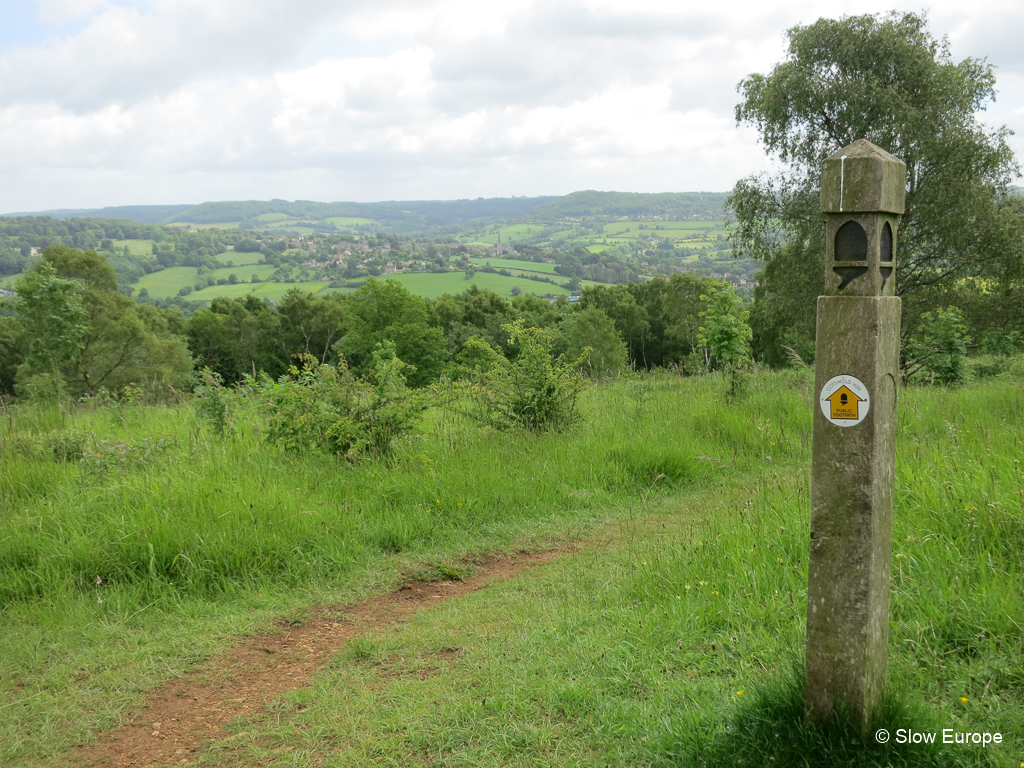
The Trail is Easy to Follow
The Cotswold Way is well signed. Look for posts topped with the acorn symbol for the National Trails or round trail markers on fences and gates. Make sure the trail marker says "Cotswold Way". The new "Cotswold Way Circular Walk" markers are confusing - they are not the ones to follow. Sign posts or markers are at every turning point on the trail. If the trail has been changed, the new route is clearly marked.
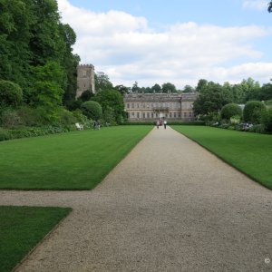
Day 9 - Painswick to Kings Stanley.
Up and Down, Up and Down
This is very much an "up and down", "never take a straight line" walk. It was not designed to get you from Chipping Campden to Bath in the shortest time. Instead it was designed to let you see as much as possible along the way, to take you up to viewpoints and then down to the charming villages. Every day you climb up to the top of the escarpment at least once. The usual climbs are from 500 to 800 feet (150 - 250 meters).
Chipping Campden is 500 feet (150 meters) above sea level, Bath just less than 150 feet (50 meters). The escarpment is around 1000 feet (300 meters) above sea level.
Wear Good Walking Gear
You need basic day walking gear - walking boots or shoes, a backpack to carry water, rain jackets, etc. Walking poles are useful.
How Many Days?
Most people walk the Cotswold Way in 7 to 15 days. It depends on how much time you want to spend walking each day and your level of fitness.
The National Trail Guide gives a 15-day version of the walk, with 6 - 8 miles of walking each day. Each day has at least one good climb to the top of the escarpment, many days have two climbs. We walked about 2 miles per hour (an average pace), so each day was 3 - 4 hours of walking, leaving time to explore the sights along the way. We did the 15-day easy version of the Cotswold Way our first time but did longer walking days on our second time (10 days). Many people do a 7 - 10 day version by combining some of the days. We once met someone doing the walk in four days - 25 miles per day - and sleeping at the side of the trail.
How to Walk the Cotswold Way
There are two things to think about when planning your walk.
A visitor can easily combine staying in a vacation rental (holiday cottage) and walking the trail. Rent a vacation rental in the north Cotswolds for a week for the first half of the walk and then move to another in the south for the second week. Or pick a vacation rental in a central place and spend two weeks there. From your vacation rental, drive out for each day's walk, park at the starting point, do the walk and return to your car by bus or taxi. (It sometimes works best to park at the end point, then take a bus or taxi to the starting point and walk back to your car.)
You don't have to do the whole trail on one trip. You could do the northern part of the trail one year, then return to do the southern part another year. Or choose a few segments and only do those. There are many ways to approach the Cotswold Way walk.
We decided to do the entire trail from our base in the Cotswolds. We live in Painswick which is the half-way point of the trail. We did not want to do the trail on consecutive days, staying in B&Bs because we wanted the convenience of having dinner and breakfast at home and sleeping in one place. This meant we had to do more driving, but it was worth it. We also scheduled our walking days according to the weather and how we felt.

Day 6 - Dowdswell to Leckhampton Hill.
15-day Version of the Cotswold Way Trail
This is the route recommended in the National Trail guide. When walking from north to south (Chipping Campden to Bath), the trail starts with shorter days (5 - 6 miles) and then gets into longer days (7 - 10 miles). This version of the walk lets you go at a leisurely pace.
Notes below show how to combine days to make a 10-day walk.
We did the 15-day version of the Cotswold Way and found it an easy distance to walk each day.
Day 1: Chipping Campden - Broadway (6 miles)
Day 2: Broadway - Wood Stanway (6.5 miles)
Day 3: Wood Stanway - Winchcombe (5.4 miles)
10-Day Walk: Turn days 1, 2 and 3 into two days by stopping at Stanton instead of Broadway and Wood Stanway.
Chipping Campden - Stanton (10.3 miles)
Stanton - Winchcombe (7.8 miles)
OR do day 1 as shown and combine days 2 and 3.
Broadway - Winchcombe (11.9 miles)
Day 4: Winchcombe - Cleeve Hill (5.6 miles)
Day 5: Cleeve Hill - Dowdeswell (5.5 miles)
10-Day Walk: Combine days 4 and 5.
Winchcombe - Dowdeswell (11.1 miles)
Day 6: Dowdeswell - Leckhampton Hill (4.7 miles)
Day 7: Leckhampton Hill - Birdlip (5.6 miles)
10-Day Walk: Combine days 6 and 7.
Dowdeswell - Birdlip (10.3 miles)
Day 8: Birdlip - Painswick (8.6 miles)
Note that you walk through the Painswick Golf Course at the end of this day and walkers and golfers share the area (neither have right of way over the other). Watch out for golfers and golf balls.
Day 9: Painswick - King's Stanley (7.8 miles)
Day 10: King's Stanley - Dursley (7.2 miles)
10-Day Walk: Combine days 9 and 10.
Painswick - Dursley (15 miles)
Day 11: Dursley - Wotton-under-Edge (7.3 miles)
Day 12: Wotton-under-Edge - Hawkesbury (7.4 miles)
Day 13: Hawkesbury - Tormarton (7.7 miles)
Day 14: Tormarton - Cold Ashton (6.6 miles)
10-Day Walk: Combine Days 13 and 14.
Hawkesbury - Cold Ashton (14.3 miles)
Day 15: Cold Ashton - Bath (10.2 miles)
Cotswold Way Circular Walks
If you don't want to use transportation to return to your car, you can do many parts of the Cotswold Way as day hikes, starting and ending from the same spot.
National Trails - Cotswold Way Circular Walks - downloadable walks covering several sections of the Cotswold Way (if you want to try out parts of the Cotswold Way).
How to Walk the Cotswolds Way from One Base (in 15 days)
Most visitors to the Cotswolds who want to walk the Cotswold Way do it by walking the whole trail on consecutive days, staying in B&Bs along the way. People who live in this area have the flexibility of walking the trail in many ways. They can walk a few days one month, a few days the next. Or they can do the whole trail but return home each evening.
A visitor can easily combine staying in a vacation rental (holiday cottage) and walking the trail. Rent a vacation rental in the north Cotswolds for a week for the first half of the walk and then move to another in the south for the second week. Or pick a vacation rental in a central place and spend two weeks there. From your vacation rental, drive out for each day's walk, park at the starting point, do the walk and return to your car by bus or taxi. (It sometimes works best to park at the end point, then take a bus or taxi to the starting point and walk back to your car.)
The information below tells you how to do the Cotswold Way as a series of day walks using buses or taxis to get you back to your starting point each day.
Steve and I have walked the Cotswold Way three times. The last time we skipped a few of the days we didn't like on previous hikes. The information below is from our first walk in June 2013. We lived in a village near the mid-point of the trail and did the walk in 14 days, as a series of day hikes, returning home each evening. Instead of walking on consecutive days and overnighting in B&Bs, we drove out and back each day and used buses and taxis to get us back to our car after walking (or before). That way we did not walk on wet days and could rest up after long days.
We walked the trail again in summer 2014 and did it in 11 days (we stopped a few miles from Bath because it was a very hot day). We did most parts of the trail again 2015.
Cotswold Way Transportation
Parking: Most of the towns along the Cotswold Way have car parks for visitors. Check to see if they have a "Long Stay" car park because the usual "Short Stay" car park will have a time limit. The Long Stay car park is less expensive or free, but is usually further out than the Short Stay car park.
Bus Service: Many places along the Cotswold Way have infrequent bus service. In some cases it may be easier to park at the end point of the walk, take a morning bus to the start point and then walk to your car. From some points you may have to take a taxi or do an extra walk to the bus line.
Buses for each location are listed below. Find bus schedules on Traveline South West.
Note that buses do not run on Sunday.
Taxi Service: Check on Google or go to the local tourist office for a list of local taxis. Many taxi companies in these small Cotswold towns are one-man shops and may be busy when you need them. Either book ahead or be prepared to make several phone calls. Taxis are easier to get on the parts of the walk near larger cities (Cheltenham, Stroud, Chipping Sodbury, Bath).
Trail Details
Day 1: Chipping Campden - Broadway (6 miles)
This is an easy first day to start your walk. You climb out of Chipping Campden to Dover's Hill, then walk along the escarpment to Broadway Tower. From there you go down into Broadway.
Lunch: There are several places to get sandwiches in Chipping Campden. Stop at the picnic area at Fish Hill or the tea room near Broadway Tower.
Parking: Start of walk - Chipping Campden, free long term parking is on Back Ends, park on road or in the few spaces provided. End of walk - Broadway, paid long term parking lot on Leamington Road.
Transportation: Buses run between Chipping Campden and Broadway. Either park in Chipping Campden, walk to Broadway and take the afternoon bus back or park in Broadway, take the morning bus to Chipping Campden and walk back to your car.
Day 2: Broadway - Wood Stanway (6.5 miles)
Climb from Broadway back up to the top of the escarpment, then follow farm tracks until the descent into Stanton. Walk through Stanton, then across fields to Stanway. The National Trail Guide suggests you walk to Wood Stanway, but if you are taking a bus back, stop at Stanway, then walk .8 miles to the Toddington roundabout on B4632 where you can get a bus.
Lunch: Great sandwiches at Broadway Deli on the village green. A few benches along the trail.
Parking: Start of walk - Broadway, paid long term parking lot on Leamington Road. End of walk - no parking in Stanway/Wood Stanway.
Transportation: From Stanway, walk to the Toddington roundabout to catch the bus.
We thought it would be easy to call a taxi from Wood Stanway but we had to phone eight companies before we found one available (£20). We should have walked to Toddington roundabout for the bus.
Day 3: Wood Stanway - Winchcombe (5.4 miles)
From Wood Stanway you climb back up to the escarpment, walk along it, then descend to Hailes Abbey (remains of a Cistercian abbey). From there you walk across fields to Winchcombe.
Lunch: No shops in Stanway or Wood Stanway. Tea room near Hailes Abbey at Hayles Fruit Farm.
Parking: Start of walk - no parking in Stanway/Wood Stanway. End of walk - Winchcombe, paid long term parking lot in Back Lane.
Transportation: Buses run between Winchcombe and Broadway, stopping near Wood Stanway, Stanway and Stanton.
Day 4: Winchcombe - Cleeve Hill (5.6 miles)
From Winchcombe you walk out through fields, slowly climbing towards Belas Knapp, a pre-historic burial mound on the edge of the escarpment. From there you go along the escarpment, down to Postlip, then up again to Cleeve Hill.
Lunch: Food Fanatics in Winchcombe has good sandwiches.
Parking: Start of walk - Winchcombe, paid long term parking in Back Lane. End of walk - Cleeve Hill, free Quarry parking near Golf Course.
Transportation: Bus from Cheltenham goes between Cleeve Hill and Winchcombe.
Day 5: Cleeve Hill - Dowdeswell (5.5 miles)
The next three days take you around the large town of Cheltenham. Today's walk goes over the Cleeve Hill Commons with views back up the escarpment to where you started and down to Cheltenham. The walk ends at Dowdeswell Reservoir, on the A40 road that runs from Cheltenham to Oxford.
Lunch: Bring your own for today.
Parking: Start of walk - Cleeve Hill, free Quarry parking near Golf Course. End of walk - Koloshi Restaurant on the A40 (London Road) across from Dowdeswell Reservoir (they allow walkers to use their large parking area).
Transportation: Buses run from Dowdeswell to Cheltenham where you can transfer to a bus to Winchcombe. Or take a taxi from Cheltenham.
Day 6: Dowdeswell - Leckhampton Hill (4.7 miles)
This is a short day of walking. Even though you are walking near busy roads and are not far from the edge of Cheltenham, this walk is very rural and beautiful. The Lineover Wood with the old Lime Trees is spectacular. Leckhampton Hill has beautiful views over Cheltenham.
Lunch: Bring your own for today.
Parking: Start of walk - Koloshi Restaurant on the A40 (London Road) across from Dowdeswell Wood (they allow walkers to use their large parking area). End of walk - quarry on Hartley Lane off Leckhampton Hill Road.
Transportation: Buses run from Leckhampton Hill to Cheltenham where you can transfer to a bus to Dowdeswell. Or take a taxi from Cheltenham.
Day 7: Leckhampton Hill - Birdlip (5.6 miles)
This is the worst day of the walk because of the very busy A417 roadway. The noise from the road dominates the walk, plus you have to cross a very busy roundabout and walk beside the road for about 5 minutes. You walk through an interesting pre-historic fort on Crickley Hill.
Lunch: Bring your own for today.
Parking: Start of walk - quarry on Hartley Lane off Leckhampton Hill Road. End of walk - car park at Barrow Wake Viewpoint near Birdlip.
Transportation: You may be able to do this by bus, but a taxi is quicker.
Day 8: Birdlip - Painswick (8.6 miles)
Finally a mostly flat walk. You walk through beautiful woods along the edge of the escarpment with one short climb to the top of Cooper's Hill (where they do the cheese rolling contests), then out along the beautiful Painswick Beacon, and into Painswick.
Lunch: Sandwiches in Painswick at the tea room or the local shop. A pub just off the trail before the Painswick Beacon.
Parking: Start of walk - car park at Barrow Wake Viewpoint near Birdlip. End of walk - Walker's Car Park on Golf Course Road off the Gloucester Road in Painswick.
Transportation: The bus routes are complicated here. Use a taxi from Cheltenham or Stroud.
Day 9: Painswick - King's Stanley (7.8 miles)
This day takes you from Painswick up to the Haresfield Beacon with views south to the River Severn, then through the beautiful Standish Wood and down to the Stroudwater Canal. This is a populated area but the walk goes through rural parts.
Lunch: Sandwiches in Painswick (see above), pub in Edge.
Parking: Start of walk - Walker's Car Park on Golf Course Road off the Gloucester Road in Painswick. End of walk - parking lot off the Ebley Bypass (A419) on the road into Kings Stanley (Ryeford Road).
Transportation: Buses run along the Ebley Road near King's Stanley. There is a bus stop where the trail crosses the road. Buses go to Stroud where you can catch the bus to Painswick. There are taxi companies in Stroud.
Day 10: King's Stanley - Dursley (7.2 miles)
The guide offers two routes. We took the more direct route along the edge of King's Stanley and Leonard Stanley then through Middleyard and up to the escarpment, instead of the longer route that goes through Selsley. This walk goes through woods along the edge of the escarpment to a viewpoint at Coaley Peak Viewpoint (with the pre-historic Nympsfield Long Barrow), continuing along the escarpment to pre-historic Uley Bury where you go down to the valley bottom and a steep climb up to Long Cam Down, with more lovely views. Then a long downhill to Dursley.
Lunch: There are some options in King's Stanley to get sandwiches.
Parking: Start of walk - parking lot off the Ebley Bypass (A419) on the road into Kings Stanley (Ryeford Road). End of walk - long stay car park in Dursley near the college (down Long Street off the market square).
Transportation: Bus from Uley/Dursley to Stroud (bus stop in the center of town just down from the market square near the Sainsburys). This is a 45 minute bus ride - it meanders through many villages.
Day 11: Dursley - Wotton-under-Edge (7.3 miles)
This walk starts with a climb through woods up to the escarpment and a golf course. You are then offered the option of a quick 1/2 mile across the golf course or two miles walking along the edge of the escarpment, woods on one side, golf course on the other, ending up almost where you started. We did the long route because that is the official trail and it was a nice walk.
Lunch: Sandwiches in Dursley. The trail goes along the main pedestrian shopping street with many options, or try the Sainsbury's.
Parking: Start of walk - long stay car park in Dursley near the college (down Long Street off the market square). End of walk - long stay car park in Wotton. The main car park in the center of town has two sections - short stay and long stay.
Transportation: Bus from Thornbury - Dursley stops in Wotton.
Day 12: Wotton-under-Edge - Hawkesbury (7.4 miles)
This walk starts with a long climb to the escarpment, then takes you to the village of Hawkesbury.
Lunch: Many options in Wotton.
Parking: There is Long Stay Car Park in the town center.
Transportation: Bus from Hawkesbury to Wotton.
Day 13: Hawkesbury - Tormarton (7.7 miles)
Today you walk through a large estate, cross the busy A36 and end up in another village. Not much climbing.
Lunch: Not many options here.
Parking: Parking on the road in Hawkesbury or Tormarton.
Transportation: Buses difficult in this area, arrange for a taxi. Tax companies in Chipping Sodbury.
Day 14: Tormarton - Cold Ashton (6.6 miles)
Another day without big climbs. You cross over the M4 motorway on a bridge, cross the busy A36 again.
Lunch: Not many options here.
Parking: Parking on the road in Tormarton or in the car park in Cold Ashton.
Transportation: Buses difficult in this area, arrange for a taxi.
Day 15: Cold Ashton - Bath (10.2 miles)
The final day is a long downhill to Bath.
Lunch: Not many options here.
Parking: Park in the car park in Cold Ashton.
Transportation: Taxi or bus from Bath back to Cold Ashton.
Resources
Chipping Campden at the start of the trail.

More Photos
Photos from our first time walking the Cotswold Way in June 2013, when we lived in Painswick, at the mid-point.
Author: Pauline Kenny, July 2013, updated August 2015.
The trail is well signed and easy to follow. There is a fair amount of climbing as it takes the walker up and down the escarpment. You can do the trail at your own pace (7 to 15 days), spending nights in B&Bs along the way or staying in one base and driving out to each day's starting point.
Books and Maps for Planning
Cotswold Way (National Trail Guides) by Anthony Burton. Purchase on amazon.co.uk to get the most recent edition. Contains detailed maps and descriptions of the trail. This book combined with this page and the National Trails website give you the information you need to plan your Cotswold Way walk. National Trail Guides has a companion book listing B&Bs and luggage transfer services along the trail to help with your planning.
The Cotswolds-based Cotswold Walks will organize your walk for you, booking B&Bs, luggage transfer and giving you walking advice.
The Trail is Easy to Follow
The Cotswold Way is well signed. Look for posts topped with the acorn symbol for the National Trails or round trail markers on fences and gates. Make sure the trail marker says "Cotswold Way". The new "Cotswold Way Circular Walk" markers are confusing - they are not the ones to follow. Sign posts or markers are at every turning point on the trail. If the trail has been changed, the new route is clearly marked.
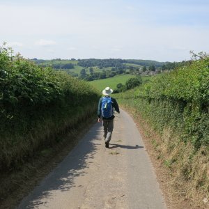
- The walking surface of the trail varies. You walk through villages, farm fields, meadows and woods. In some places the trail is wide, allowing you to walk side by side. In other places it is a narrow path. You walk on paved lanes occasionally, but most of the trail is off-road.
- The trail is well maintained. If one part is very steep, wooden steps might be cut into the trail. You don't have to walk through rivers - there will be a bridge. It is not overgrown and difficult to walk.
- The trail takes you through pastures of sheep, cows or horses. If the weather has been wet, there will be mud.
Day 9 - Painswick to Kings Stanley.
Up and Down, Up and Down
This is very much an "up and down", "never take a straight line" walk. It was not designed to get you from Chipping Campden to Bath in the shortest time. Instead it was designed to let you see as much as possible along the way, to take you up to viewpoints and then down to the charming villages. Every day you climb up to the top of the escarpment at least once. The usual climbs are from 500 to 800 feet (150 - 250 meters).
Chipping Campden is 500 feet (150 meters) above sea level, Bath just less than 150 feet (50 meters). The escarpment is around 1000 feet (300 meters) above sea level.
Wear Good Walking Gear
You need basic day walking gear - walking boots or shoes, a backpack to carry water, rain jackets, etc. Walking poles are useful.
How Many Days?
Most people walk the Cotswold Way in 7 to 15 days. It depends on how much time you want to spend walking each day and your level of fitness.
The National Trail Guide gives a 15-day version of the walk, with 6 - 8 miles of walking each day. Each day has at least one good climb to the top of the escarpment, many days have two climbs. We walked about 2 miles per hour (an average pace), so each day was 3 - 4 hours of walking, leaving time to explore the sights along the way. We did the 15-day easy version of the Cotswold Way our first time but did longer walking days on our second time (10 days). Many people do a 7 - 10 day version by combining some of the days. We once met someone doing the walk in four days - 25 miles per day - and sleeping at the side of the trail.
How to Walk the Cotswold Way
There are two things to think about when planning your walk.
- Where to spend the night between walking days (B&Bs along the way or return to a base).
- How to arrange the walking days (consecutive days or not).
A visitor can easily combine staying in a vacation rental (holiday cottage) and walking the trail. Rent a vacation rental in the north Cotswolds for a week for the first half of the walk and then move to another in the south for the second week. Or pick a vacation rental in a central place and spend two weeks there. From your vacation rental, drive out for each day's walk, park at the starting point, do the walk and return to your car by bus or taxi. (It sometimes works best to park at the end point, then take a bus or taxi to the starting point and walk back to your car.)
You don't have to do the whole trail on one trip. You could do the northern part of the trail one year, then return to do the southern part another year. Or choose a few segments and only do those. There are many ways to approach the Cotswold Way walk.
We decided to do the entire trail from our base in the Cotswolds. We live in Painswick which is the half-way point of the trail. We did not want to do the trail on consecutive days, staying in B&Bs because we wanted the convenience of having dinner and breakfast at home and sleeping in one place. This meant we had to do more driving, but it was worth it. We also scheduled our walking days according to the weather and how we felt.
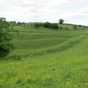
Day 6 - Dowdswell to Leckhampton Hill.
15-day Version of the Cotswold Way Trail
This is the route recommended in the National Trail guide. When walking from north to south (Chipping Campden to Bath), the trail starts with shorter days (5 - 6 miles) and then gets into longer days (7 - 10 miles). This version of the walk lets you go at a leisurely pace.
Notes below show how to combine days to make a 10-day walk.
We did the 15-day version of the Cotswold Way and found it an easy distance to walk each day.
Day 1: Chipping Campden - Broadway (6 miles)
Day 2: Broadway - Wood Stanway (6.5 miles)
Day 3: Wood Stanway - Winchcombe (5.4 miles)
10-Day Walk: Turn days 1, 2 and 3 into two days by stopping at Stanton instead of Broadway and Wood Stanway.
Chipping Campden - Stanton (10.3 miles)
Stanton - Winchcombe (7.8 miles)
OR do day 1 as shown and combine days 2 and 3.
Broadway - Winchcombe (11.9 miles)
Day 4: Winchcombe - Cleeve Hill (5.6 miles)
Day 5: Cleeve Hill - Dowdeswell (5.5 miles)
10-Day Walk: Combine days 4 and 5.
Winchcombe - Dowdeswell (11.1 miles)
Day 6: Dowdeswell - Leckhampton Hill (4.7 miles)
Day 7: Leckhampton Hill - Birdlip (5.6 miles)
10-Day Walk: Combine days 6 and 7.
Dowdeswell - Birdlip (10.3 miles)
Day 8: Birdlip - Painswick (8.6 miles)
Note that you walk through the Painswick Golf Course at the end of this day and walkers and golfers share the area (neither have right of way over the other). Watch out for golfers and golf balls.
Day 9: Painswick - King's Stanley (7.8 miles)
Day 10: King's Stanley - Dursley (7.2 miles)
10-Day Walk: Combine days 9 and 10.
Painswick - Dursley (15 miles)
Day 11: Dursley - Wotton-under-Edge (7.3 miles)
Day 12: Wotton-under-Edge - Hawkesbury (7.4 miles)
Day 13: Hawkesbury - Tormarton (7.7 miles)
Day 14: Tormarton - Cold Ashton (6.6 miles)
10-Day Walk: Combine Days 13 and 14.
Hawkesbury - Cold Ashton (14.3 miles)
Day 15: Cold Ashton - Bath (10.2 miles)
Cotswold Way Circular Walks
If you don't want to use transportation to return to your car, you can do many parts of the Cotswold Way as day hikes, starting and ending from the same spot.
National Trails - Cotswold Way Circular Walks - downloadable walks covering several sections of the Cotswold Way (if you want to try out parts of the Cotswold Way).
How to Walk the Cotswolds Way from One Base (in 15 days)
Most visitors to the Cotswolds who want to walk the Cotswold Way do it by walking the whole trail on consecutive days, staying in B&Bs along the way. People who live in this area have the flexibility of walking the trail in many ways. They can walk a few days one month, a few days the next. Or they can do the whole trail but return home each evening.
A visitor can easily combine staying in a vacation rental (holiday cottage) and walking the trail. Rent a vacation rental in the north Cotswolds for a week for the first half of the walk and then move to another in the south for the second week. Or pick a vacation rental in a central place and spend two weeks there. From your vacation rental, drive out for each day's walk, park at the starting point, do the walk and return to your car by bus or taxi. (It sometimes works best to park at the end point, then take a bus or taxi to the starting point and walk back to your car.)
The information below tells you how to do the Cotswold Way as a series of day walks using buses or taxis to get you back to your starting point each day.
Steve and I have walked the Cotswold Way three times. The last time we skipped a few of the days we didn't like on previous hikes. The information below is from our first walk in June 2013. We lived in a village near the mid-point of the trail and did the walk in 14 days, as a series of day hikes, returning home each evening. Instead of walking on consecutive days and overnighting in B&Bs, we drove out and back each day and used buses and taxis to get us back to our car after walking (or before). That way we did not walk on wet days and could rest up after long days.
We walked the trail again in summer 2014 and did it in 11 days (we stopped a few miles from Bath because it was a very hot day). We did most parts of the trail again 2015.
Cotswold Way Transportation
Parking: Most of the towns along the Cotswold Way have car parks for visitors. Check to see if they have a "Long Stay" car park because the usual "Short Stay" car park will have a time limit. The Long Stay car park is less expensive or free, but is usually further out than the Short Stay car park.
Bus Service: Many places along the Cotswold Way have infrequent bus service. In some cases it may be easier to park at the end point of the walk, take a morning bus to the start point and then walk to your car. From some points you may have to take a taxi or do an extra walk to the bus line.
Buses for each location are listed below. Find bus schedules on Traveline South West.
Note that buses do not run on Sunday.
Taxi Service: Check on Google or go to the local tourist office for a list of local taxis. Many taxi companies in these small Cotswold towns are one-man shops and may be busy when you need them. Either book ahead or be prepared to make several phone calls. Taxis are easier to get on the parts of the walk near larger cities (Cheltenham, Stroud, Chipping Sodbury, Bath).
Trail Details
Day 1: Chipping Campden - Broadway (6 miles)
This is an easy first day to start your walk. You climb out of Chipping Campden to Dover's Hill, then walk along the escarpment to Broadway Tower. From there you go down into Broadway.
Lunch: There are several places to get sandwiches in Chipping Campden. Stop at the picnic area at Fish Hill or the tea room near Broadway Tower.
Parking: Start of walk - Chipping Campden, free long term parking is on Back Ends, park on road or in the few spaces provided. End of walk - Broadway, paid long term parking lot on Leamington Road.
Transportation: Buses run between Chipping Campden and Broadway. Either park in Chipping Campden, walk to Broadway and take the afternoon bus back or park in Broadway, take the morning bus to Chipping Campden and walk back to your car.
Day 2: Broadway - Wood Stanway (6.5 miles)
Climb from Broadway back up to the top of the escarpment, then follow farm tracks until the descent into Stanton. Walk through Stanton, then across fields to Stanway. The National Trail Guide suggests you walk to Wood Stanway, but if you are taking a bus back, stop at Stanway, then walk .8 miles to the Toddington roundabout on B4632 where you can get a bus.
Lunch: Great sandwiches at Broadway Deli on the village green. A few benches along the trail.
Parking: Start of walk - Broadway, paid long term parking lot on Leamington Road. End of walk - no parking in Stanway/Wood Stanway.
Transportation: From Stanway, walk to the Toddington roundabout to catch the bus.
We thought it would be easy to call a taxi from Wood Stanway but we had to phone eight companies before we found one available (£20). We should have walked to Toddington roundabout for the bus.
Day 3: Wood Stanway - Winchcombe (5.4 miles)
From Wood Stanway you climb back up to the escarpment, walk along it, then descend to Hailes Abbey (remains of a Cistercian abbey). From there you walk across fields to Winchcombe.
Lunch: No shops in Stanway or Wood Stanway. Tea room near Hailes Abbey at Hayles Fruit Farm.
Parking: Start of walk - no parking in Stanway/Wood Stanway. End of walk - Winchcombe, paid long term parking lot in Back Lane.
Transportation: Buses run between Winchcombe and Broadway, stopping near Wood Stanway, Stanway and Stanton.
Day 4: Winchcombe - Cleeve Hill (5.6 miles)
From Winchcombe you walk out through fields, slowly climbing towards Belas Knapp, a pre-historic burial mound on the edge of the escarpment. From there you go along the escarpment, down to Postlip, then up again to Cleeve Hill.
Lunch: Food Fanatics in Winchcombe has good sandwiches.
Parking: Start of walk - Winchcombe, paid long term parking in Back Lane. End of walk - Cleeve Hill, free Quarry parking near Golf Course.
Transportation: Bus from Cheltenham goes between Cleeve Hill and Winchcombe.
Day 5: Cleeve Hill - Dowdeswell (5.5 miles)
The next three days take you around the large town of Cheltenham. Today's walk goes over the Cleeve Hill Commons with views back up the escarpment to where you started and down to Cheltenham. The walk ends at Dowdeswell Reservoir, on the A40 road that runs from Cheltenham to Oxford.
Lunch: Bring your own for today.
Parking: Start of walk - Cleeve Hill, free Quarry parking near Golf Course. End of walk - Koloshi Restaurant on the A40 (London Road) across from Dowdeswell Reservoir (they allow walkers to use their large parking area).
Transportation: Buses run from Dowdeswell to Cheltenham where you can transfer to a bus to Winchcombe. Or take a taxi from Cheltenham.
Day 6: Dowdeswell - Leckhampton Hill (4.7 miles)
This is a short day of walking. Even though you are walking near busy roads and are not far from the edge of Cheltenham, this walk is very rural and beautiful. The Lineover Wood with the old Lime Trees is spectacular. Leckhampton Hill has beautiful views over Cheltenham.
Lunch: Bring your own for today.
Parking: Start of walk - Koloshi Restaurant on the A40 (London Road) across from Dowdeswell Wood (they allow walkers to use their large parking area). End of walk - quarry on Hartley Lane off Leckhampton Hill Road.
Transportation: Buses run from Leckhampton Hill to Cheltenham where you can transfer to a bus to Dowdeswell. Or take a taxi from Cheltenham.
Day 7: Leckhampton Hill - Birdlip (5.6 miles)
This is the worst day of the walk because of the very busy A417 roadway. The noise from the road dominates the walk, plus you have to cross a very busy roundabout and walk beside the road for about 5 minutes. You walk through an interesting pre-historic fort on Crickley Hill.
Lunch: Bring your own for today.
Parking: Start of walk - quarry on Hartley Lane off Leckhampton Hill Road. End of walk - car park at Barrow Wake Viewpoint near Birdlip.
Transportation: You may be able to do this by bus, but a taxi is quicker.
Day 8: Birdlip - Painswick (8.6 miles)
Finally a mostly flat walk. You walk through beautiful woods along the edge of the escarpment with one short climb to the top of Cooper's Hill (where they do the cheese rolling contests), then out along the beautiful Painswick Beacon, and into Painswick.
Lunch: Sandwiches in Painswick at the tea room or the local shop. A pub just off the trail before the Painswick Beacon.
Parking: Start of walk - car park at Barrow Wake Viewpoint near Birdlip. End of walk - Walker's Car Park on Golf Course Road off the Gloucester Road in Painswick.
Transportation: The bus routes are complicated here. Use a taxi from Cheltenham or Stroud.
Day 9: Painswick - King's Stanley (7.8 miles)
This day takes you from Painswick up to the Haresfield Beacon with views south to the River Severn, then through the beautiful Standish Wood and down to the Stroudwater Canal. This is a populated area but the walk goes through rural parts.
Lunch: Sandwiches in Painswick (see above), pub in Edge.
Parking: Start of walk - Walker's Car Park on Golf Course Road off the Gloucester Road in Painswick. End of walk - parking lot off the Ebley Bypass (A419) on the road into Kings Stanley (Ryeford Road).
Transportation: Buses run along the Ebley Road near King's Stanley. There is a bus stop where the trail crosses the road. Buses go to Stroud where you can catch the bus to Painswick. There are taxi companies in Stroud.
Day 10: King's Stanley - Dursley (7.2 miles)
The guide offers two routes. We took the more direct route along the edge of King's Stanley and Leonard Stanley then through Middleyard and up to the escarpment, instead of the longer route that goes through Selsley. This walk goes through woods along the edge of the escarpment to a viewpoint at Coaley Peak Viewpoint (with the pre-historic Nympsfield Long Barrow), continuing along the escarpment to pre-historic Uley Bury where you go down to the valley bottom and a steep climb up to Long Cam Down, with more lovely views. Then a long downhill to Dursley.
Lunch: There are some options in King's Stanley to get sandwiches.
Parking: Start of walk - parking lot off the Ebley Bypass (A419) on the road into Kings Stanley (Ryeford Road). End of walk - long stay car park in Dursley near the college (down Long Street off the market square).
Transportation: Bus from Uley/Dursley to Stroud (bus stop in the center of town just down from the market square near the Sainsburys). This is a 45 minute bus ride - it meanders through many villages.
Day 11: Dursley - Wotton-under-Edge (7.3 miles)
This walk starts with a climb through woods up to the escarpment and a golf course. You are then offered the option of a quick 1/2 mile across the golf course or two miles walking along the edge of the escarpment, woods on one side, golf course on the other, ending up almost where you started. We did the long route because that is the official trail and it was a nice walk.
Lunch: Sandwiches in Dursley. The trail goes along the main pedestrian shopping street with many options, or try the Sainsbury's.
Parking: Start of walk - long stay car park in Dursley near the college (down Long Street off the market square). End of walk - long stay car park in Wotton. The main car park in the center of town has two sections - short stay and long stay.
Transportation: Bus from Thornbury - Dursley stops in Wotton.
Day 12: Wotton-under-Edge - Hawkesbury (7.4 miles)
This walk starts with a long climb to the escarpment, then takes you to the village of Hawkesbury.
Lunch: Many options in Wotton.
Parking: There is Long Stay Car Park in the town center.
Transportation: Bus from Hawkesbury to Wotton.
Day 13: Hawkesbury - Tormarton (7.7 miles)
Today you walk through a large estate, cross the busy A36 and end up in another village. Not much climbing.
Lunch: Not many options here.
Parking: Parking on the road in Hawkesbury or Tormarton.
Transportation: Buses difficult in this area, arrange for a taxi. Tax companies in Chipping Sodbury.
Day 14: Tormarton - Cold Ashton (6.6 miles)
Another day without big climbs. You cross over the M4 motorway on a bridge, cross the busy A36 again.
Lunch: Not many options here.
Parking: Parking on the road in Tormarton or in the car park in Cold Ashton.
Transportation: Buses difficult in this area, arrange for a taxi.
Day 15: Cold Ashton - Bath (10.2 miles)
The final day is a long downhill to Bath.
Lunch: Not many options here.
Parking: Park in the car park in Cold Ashton.
Transportation: Taxi or bus from Bath back to Cold Ashton.
Resources
- Cotswold Way (National Trail Guides) by Anthony Burton. Purchase on amazon.co.uk to get the most recent edition.
- National Trails - Everything you need to know about the Cotswold Way.
- Long Distance Walkers Association - Cotswold Way - Information about the walk and an elevation chart.
- Traveline SouthWest - Transportation information
- Cotswold Walks - This local company arranges your accommodations, luggage transfer and gives you the information you need to do the walk.
Chipping Campden at the start of the trail.
More Photos
Photos from our first time walking the Cotswold Way in June 2013, when we lived in Painswick, at the mid-point.


Cotswold Way National Trail
- Pauline
- 44
- 1
National Trail that runs 102.2 miles along the Cotswold escarpment from Chipping Campden to Bath.
Author: Pauline Kenny, July 2013, updated August 2015.
Last edited: